Altitude or Attitude?
‘Safar Khoobsoorat Hai, Manzil Haseen’
Ironically true is the fact that the altitude of a peak overrides all other attributes that define it’s existence, to the tune that in numerous instances, a successful expedition to a challenging but a lower altitude peak may not find adequate acclaim in the mountaineering annals viz a viz a comparatively lower effort on a higher peak. Though, the case was certainly different with the old hands in the sport, the commercialization and associated fame has led to proliferation of the Altitude Vs Attitude debate in various quarters. Numerous schools of thoughts find each other debating the essence of mountaineering with the obsession of conquering the highest peak of the world or for that matter in all continents and even in the states of the county one resides in. This debate shall always find its life matching with the life of the sport. Stamped unanimously by the most revered and celebrated mountaineers is the notion that it is the ‘Attitude’ of a mountaineer that defines the ‘Altitude’, especially in a sport where even a few metres may make one realize one’s micro-existence amid the macro-realm of nature.
Muddled by the debate, yet fantasized by the lesser known and even less explored, one cannot beat the mystic attraction towards ‘ Phawngpui Tlang (2157M)’, the highest peak of Mizoram, plainly known as the ‘Blue Mountain’ and certainly the ‘attitude’ with which one approaches this peak.
Phawngpui Tlang (2157M)

Phawngpui Tlang _ The Blue Mountain
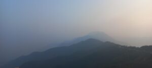
Located in the South-Eastern region of Mizoram and hugging Myanmar, in Phawngpui National Park, stands the highest peak of the state of Mizoram, the ‘Phawngpui Tlang (2157M)’. The peak forms part of Lushai Hills in the Lawngtlai District of the state. Deriving its name from the combination of Lai dialect words, ‘Phawng’ meaning ‘Meadows’ and ‘Pui’ meaning ‘Great’, the peak is a semblance of the ‘Great Grasslands’, true to its name. The thin stretch of clouds, penetrated by the sunlight through various layers of the sky, adds a bluish hue on the vast ranges and especially to the peak, christening it as the ‘Blue Mountain’
Climbing Period
Phawngpui National Park has been opened by the Government of Mizoram for eco-friendly tourism only in the dry season ranging from the month of November to April. The region witnesses heavy rainfall for the balance period of the year and is left for natural rejuvenation. Amusingly, despite being so peculiarly located and naturally blessed, the peak hasn’t seen any major footfall so far and seldom finds a mention in blogs and travelogues, an effort being made through this one (without pondering much upon the trivial reasons for its neglect).
Jumping directly to Phawngpui Tlang would be partial without writing a few words about the beautiful state of Mizoram. The southernmost landlocked state, among the seven sisters of the East, Mizoram shares its state borders with Assam, Tripura and Manipur and the International Borders with Bangladesh and Myanmar. A land of hills, valleys and rivers, one cannot miss the numerous ridge lines running predominantly in North-South direction with a substantial forest cover. The state is blessed with natural beauty and warm people from various tribes sharing erstwhile ethnic linkages with the people of Myanmar.
Aizawl : The Capital City
Aizawl, the capital city of Mizoram is the administrative and commercial hub of the state and the de-facto entry point. Well connected by air from Delhi, Guwahati, Kolkata, Imphal and Shillong, it can also be reached from Silchar, Assam on NH 540. Mizo is the widely used language in the state; however, one can converse in English, with a number of locals being familiar with the language. Polite, respecting and law abiding, Mizos are welcoming in their own way leaving you awe-struck with exemplary traffic discipline and penchant for cleanliness.
Remoteness, tough terrain and distinct demography add to the various colours of the state which primarily thrives on non-vegetarian meals and locally grown vegetables cooked with minimal oil, spices and salt (a tip for you to be logistically prepared). A skewed sunrise and sunset, owing to the geographical location of the state may leave one bewildered and doubting one’s body clock. Complementing the reveille and retreat is the routine of the locals, to the extent that a glittery evening walk as per your thoughts, attempted here, might leave you with a feel of hitting the streets at midnight. Tranquil to the core, Sundays are HOLIdays (if you get me correctly), when even the plants and birds of the state like to remember the God (bear it in mind while planning your trip).
In short, the stay in Mizoram is an amazing treat for a nature lover and travel enthusiast, who has had enough of the hustle, bustle and turbulence of mainland and seeks an emotional and physical detox (ever thought of breathing in 10 AQI?). Oh! Did I forget to wish you a NO-HONKING journey?
Let’s Get Ready
So with the prelim information in the hindsight, let’s ponder upon the aspects of packing up for the journey ahead. Simplicity is the certainly the key in this case and you just need to stick to basics.
- The peak is a trekking one, so it doesn’t require carrying any technical equipment for the climb.
- The state has a sub-tropical weather. The months between November and February are winters in Mizoram followed by Spring and setting in of storms from the month of May. The trekking period from November to April witnesses temperatures varying from 11° to 22° Celsius.
- The trek can be completed in one day from the road head but in this case, the journey and exploration are certainly for a lifetime, so take some time off than just the climb.
- So get your rucksack filled with basic trekking items, a pair of trekking shoes, trekking stick, pup tent, water bottle, torch and first aid kit to name a few. Pack light and don’t forget to carry your poncho, sleeping bag and a few layers for warmth. The air is dry in this period so make sure that your hydration and moisture are taken care of, accentuated by a suitable sunscreen. A few protein bars and electrolytes would add icing on the cake for the final trek.
The Journey
Take a week long break, ideally a Christmas break (lesser kind on pocket though) and detach yourself for the beautiful journey in the state of Blue Mountain.
- Aizawl.
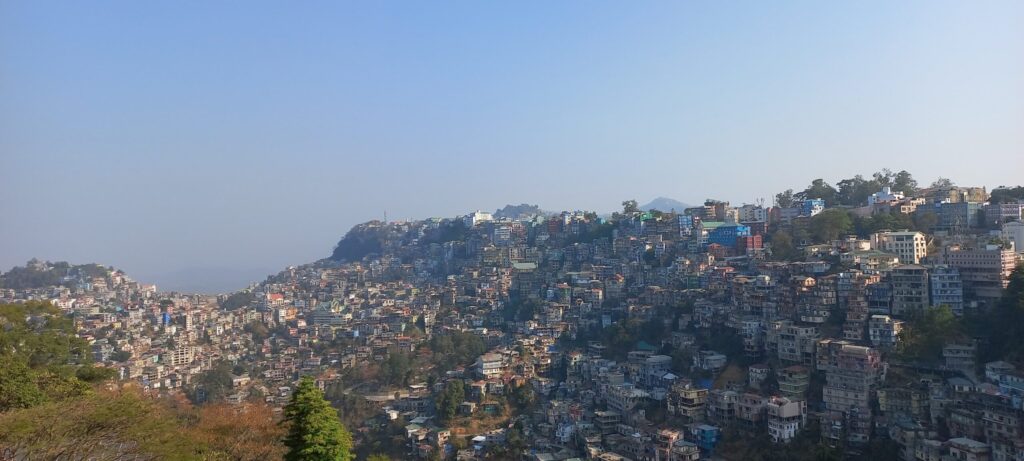
Well connected by air and road, the capital city of Mizoram is the administrative hub and the most populous city of the state. The city offers a great vibe to the tourists who not only get mesmerized by the view of multi-coloured houses spanned diligently over the countable ridges, shimmering ecstatically through the thin layers of mountainous air, but also by the urban vibe felt while seeing the high-brand stores, shops and eating joints
One can opt for a taxi to reach the city from Lengpui Airport and make a night halt at the beautiful city. Plan to book the accommodation well in advance in case you’re arriving around Christmas or New Year. Halt for a day should be fine for exploring the city and the local vibe and not to miss the night view of the glittering city like a million splendid lamps amid beautiful breeze and clean air (well, just click for some real feel).

The Splendid Night View Of Aizawl
- Transition to Serchhip.
Located at a distance of around 112 km and around three and a half hours of drive from Aizawl, in the central part of the state is the town of Serchhip. Of the two routes leading to Serchhip, the one through Hmuifang offers you spectacular views and a crossover through the ‘Tropic of Cancer’.

Passing Through The Tropic Of cancer
A tea break at Hmuifang is soul soothing and sets the pace for the journey ahead after a 360 degree view from the Hmuifang View Point. The place has beautiful rest houses and is a must if you long to spend some quality time witnessing the sunrise and sunset in the lap of nature.

An Aerial View Of Hmuifang
Around 10 km short of Serchhip is the diversion to Thenzawl, a census town in Serchhip District. The town is a well known tourist destination with a considerable plain area encompassing the beautiful township, a golf course and resort, Dilpui Lake and Fun Park and the most loved Tuirihiau Falls.

Tuirihiau Falls Thenzawl
An early start from Aizawl/ Hmuifang and one can enjoy the afternoon amidst this lap of nature before retiring at Serchhip.
- Serchhip.
Surreal Serchhip
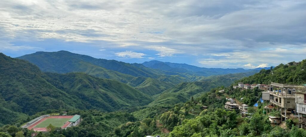
Serchhip, the seat of district administration of Serchhip District welcomes you to its folds with open arms (quite literally), with the funneled opening between ridge lines giving a spectacular view of distant settlements panning out from a world class football and athletic stadium ( just a click away for your eyes).
The township is a must stay for two reasons, first and foremost being the opportunity to do Paragliding, taking off from Bawngcham Tlang (on your click )and landing at the beautiful valley and the wet rice cultivation site of Zawlpui Leilet, a memory that certainly will remain special to you years after the trip (sharing my own memories atop on your click please).

View Of Zawlpui Leilet From Bawngcham Tlang
Second and even interesting reason is a small trek to Chawngpuii Nu Lunglen Tlang, the topmost point of Serchhip with a well constructed view point that gives you a 360 degree view of ridges, forests, streams and settlements, certainly a treat to eyes, apart from enjoying the soothing breeze and sunset from the top (adding the video taken atop with full description for you to relish on a click)
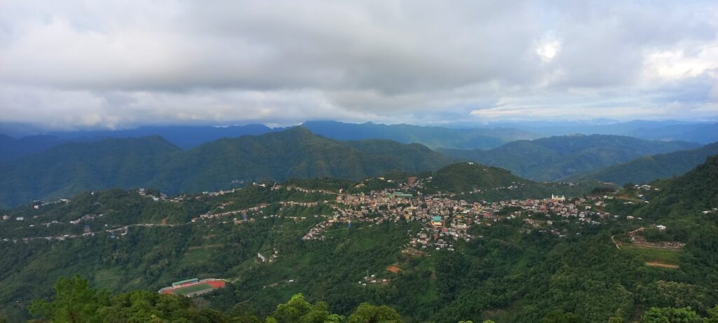
Serchhip View From Chawngpuii Nu Lunglen Tlang Trail
- Sangau
As they say, tighten your seat belts and brace yourself because you’re just one stop away from your final destination, the Phawngpui Tlang. It would be wise to have an early breakfast and start the journey to Sangau, which surely demands halting and admiring the frequently changing landscapes and still not leaving you satiated.
Leaving behind the picturesque Zawlpui Leilet, one continues on the National Highway for about 3 hours, witnessing lush green ridge lines, beautiful and clean hamlets till Hnathihal, a newly formed district headquarter and a tri-junction to Sangau, Lunglei and Thingsai.
The road to Sangau soon takes one to the famous Tuipui bridge, a vintage structure that till date can only facilitate a light vehicle over it.
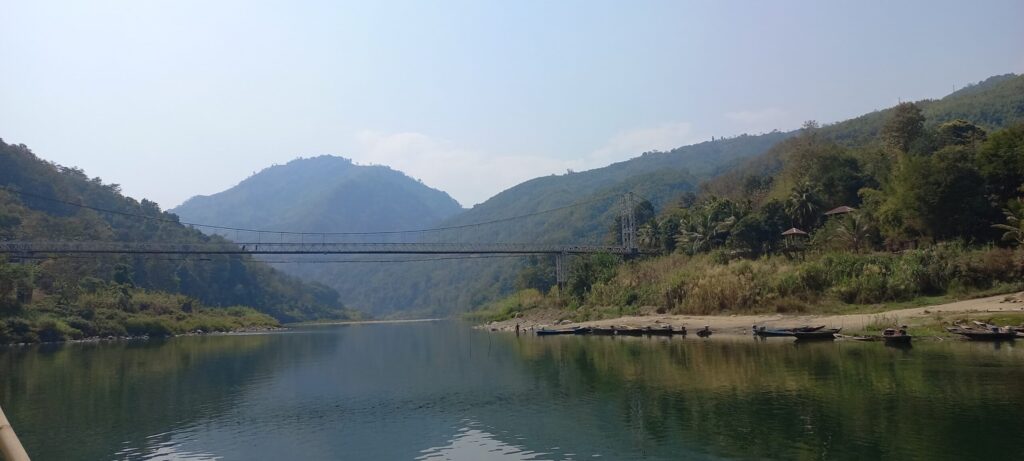
The Vintage Tuipui Bridge
Tuipui Ferry, operated by Border Roads Organisation is the lifeline for medium vehicles, which in other case would have to take a longer route from Lunglei to reach Sangau.
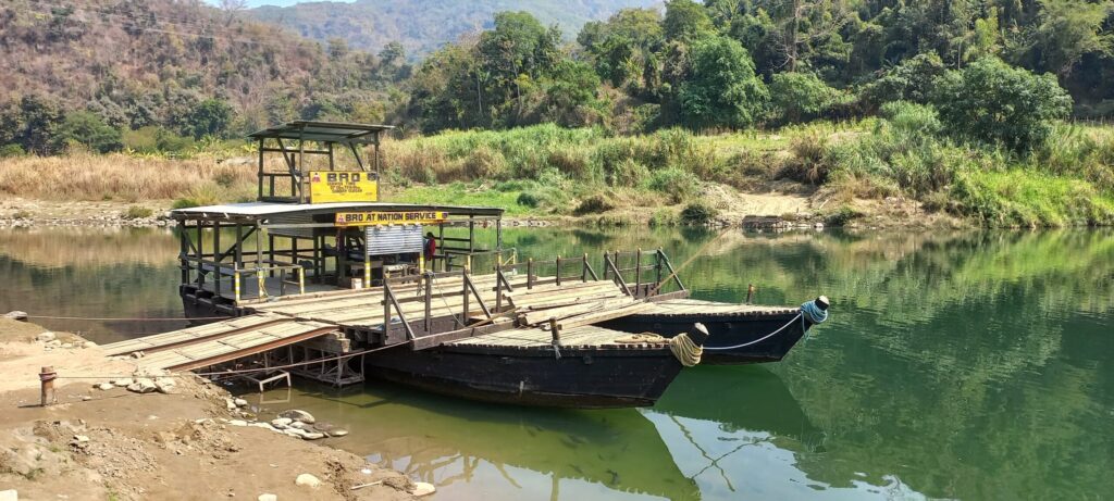
Tuipui Ferry
Do take out time to enjoy on the banks of Tuipui River with some tea and snacks from the locally run shops. Don’t be surprised to find wafers, soft drinks and eatables from Myanmar at these shops (I’ll leave it for you to reach the location and find out the reason for it).

Some Foreign Snacks
Don’t forget to feed the beautiful and bulky fish in the apple green river because you certainly aren’t allowed eating them at this location.
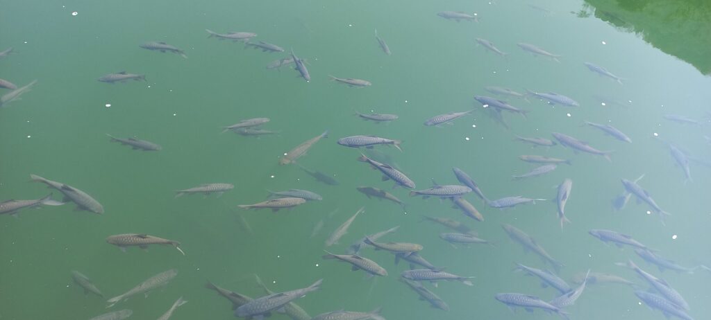
Companions Of Journey
The twists, turns and elevation gain hereafter leaves you disoriented till your reach Darzo (Yes! the Darzo tea link), a hamlet preceded by a view point to admire the routes you had traversed.
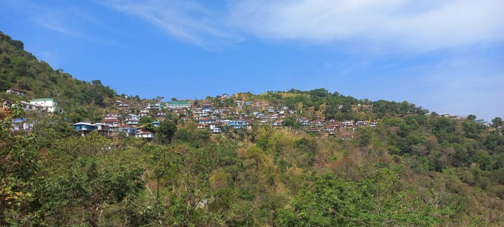
Darzo Township
The next encounter happens with South Vanlaiphai, opening up the funneled view to plain land (not so long lived view though) with rice cultivation.
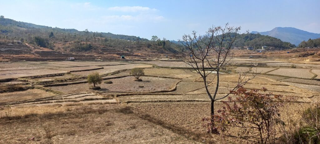
The Rice Bowl Of South Vanlaiphai
This hamlet is succeeded by a View Point, giving you the first glimpse of Phawnpui Tlang : The Blue Mountain! You reach Sangau in a few minutes and call it a day after a back-breaking, yet most satisfying journey of your trip.

The First View Of Blue Mountain
- Phawngpui Tlang
A night’s rest and one start after an early breakfast for the trek as Sangau offers the opening to Phawngpui National Park.

Sangau : The Gateway To Phawngpui National Park
The route isn’t a black top road but a motorable track. It is preferred to utilize a light or medium vehicle to reach Thaltlang, the last village before which the actual trek to Phawngpui Tlang starts.
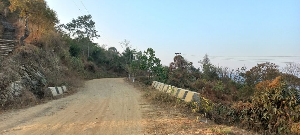
Motorable Track To Thaltlang
Thaltlang is preceded by a hamlet named Sentifiang. Both the villages present a stoic façade with a handful of memorial stones depicting the legacy of the place. One of these also brings to fore conduct of The Rhododendron Festival of Mizoram in Phawngpui National Park in March 2018 (lemme not add more fuel to your wandering brain now!).

Second To Last : Sentifiang
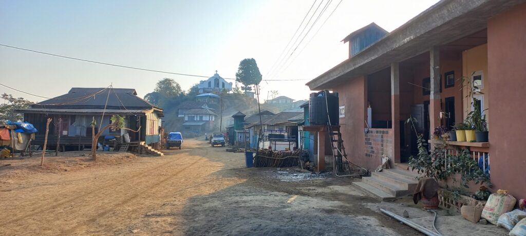
Thaltlang : The Last Hamlet
An hour’s journey on a vehicle to Thaltlang and one debuses to start the trek. There exists a Forest Check Gate/Tourist Counter right at the start point to make your entry.

Start Point Of Trek
The trail which follows is reasonably gradual and joyful. Filled with silence and intercepted by chirping of birds and your footsteps, the trail gives you an amazing sense of calmness and tranquility.A gradual climb of an hour and a half and the gate of ‘Phawngpui National Park’ welcomes you.

A Grand Welcome
Here on, the flora gets denser and the trail narrower for another half an hour till onereaches the mid-point of the trek, ‘Farpak’. Farpak, meaning ‘Pine Only’, is the main entrance to the mountain and has phenomenal pine grasslands culminating into the western cliffs, a home to mountain goats, yet believed to be haunted by spirits which certainly didn’t trouble us as we took a refreshment break near the ‘Forest Guest House’ (just in case you encounter some, do let us know!). You can leave your tents and stores here to come back and pitch for a night halt, if planned.
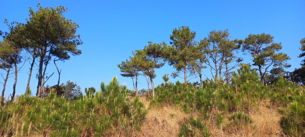
Farpak : Pine Only

Let’s Enter The Mountain

Peeping Blue Behind The Western Cliffs
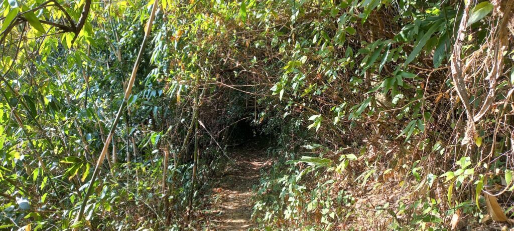
The trail that follows is quite narrow and interspersed with foliage, broken logs and forested to the extent that even the brightest sun rays would deny negotiating it for a few minutes ahead.

All Rights Restricted
The trek for next hour and a half at a moderate pace is a journey worth your lifetime with serenity, peace, nature and birds at their best to treat you.
The Trail Less Taken
One may find a few iron benches across the trail to view the majestic cliffs as one crosses two ridges lines.

Let’s Catch A Breath And A View
The trail may require you to negotiate the natural foliage and obstacles at times, so don’t forget the basics of hiking in the joy of the route.
Tough Trail Caved Ahead
A few portions would be slippery by natural off-shoot of water from the rocks, so be careful and diligent in your approach.

Rocking Times
The final step and you reach the summit that opens the enclosed trail to the widest view possible from a restricted flat patch and a dead end cliff. Difficult to put in words, I leave it for you to see the view by yourself in the captured video with full description (on a click please).
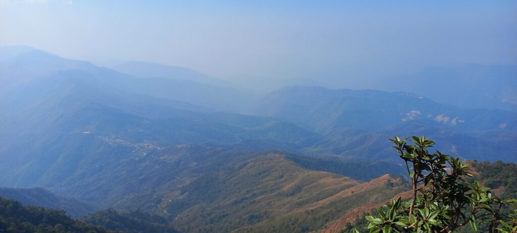
The Final Step
The summit also has a dilapidated view point. Do spend some quality time basking on the summit, sipping tea and reeling through your journey into the beautiful state of Mizoram before heading back to Farpak for a night halt under the starlit roof of nature. The next day can be used for de-induction and a recoup halt at Sangau before reaching Aizawl directly by a cab or state transport.
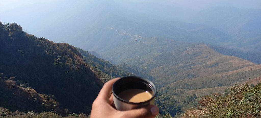
High Tea
Post Script
Having gone through the journey through my eyes, I leave it for you to decide whether it’s the attitude with which you approach a journey culminating into a summit to the highest peak of the state, which matters or is it just the altitude of a peak that counts? On a personal note, the unexplored beauty, the calmness and simplicity of locals, a disciplined and stoic way of life and countless beautiful memories of the journey makes me sum it up by saying – ‘Safar Khoobsoorat Hai, Manzil Haseen’. Do take out time to embark this beautiful journey and share your experiences in due course of time.
Mangtha Le Mizoram!