
Like Challenges? Go Alpine! (Kalindi Khal Trek Calling….)
Kalindi Khal trek/ Kalindi Khal Expedition, considered to be a near expedition traverse due to its difficulty level and technicalities, had been in my bucket list since 2015, the year when I had started my journey in the lap of mountains. With each Himalayan trip during my professional journey, the want of going through the journey of this trek was becoming even stronger and I was waiting for the right opportunity to experience this majestic journey. Needless to mention that the year 2020 brought the entire world to a ‘Stand Still’ with the COVID 19 pandemic, affecting the humankind and especially, hitting the tourism sector by confining everyone to their homes.
With the already grim situation, ADVAIT OUTDOORS, our (Lalit Yadav’s and mine) dream venture, opened to promote Alpine Trekking for experienced, passionate and ethical mountaineers was struggling for its first breath. On the flipside, the confinement of humankind was giving the much wanted healing time to mother nature as the Himalayas saw a near zero PRE-MONSOON human visitors. After a gap of around 7 months, as the government started the phased resumption of tourism, the news of a fellow adventure firm confirming a batch of Kalindi Khal trek on 12th September was heard. Taking this as a golden opportunity, we homed on to the idea of attempting Kalindi Khal Trek in Alpine Style. Yes, you read it right, the most difficult trek and that too in alpine style! (As they say, what’s life if you aren’t out of your comfort zone!)
Some thoughts resonating my mind were that apart from the challenges of the trek being Alpine in nature (self-sustained in terms of tents, technical and administrative items, food and survival), the tagging along with a fellow trekking firm would aid in documentation and coordination aspect while moving in Gangotri National Park, especially being the first one in the pandemic times. Lastly, the bucket list would get slightly empty to be filled with more goals for future.
Journey of Kalindi Khal trek in COVID 19 times.
As one would contemplate, the journey in the pandemic time wasn’t as same and as convenient as it would have been in pre COVID times. After completing the required packing, we booked the train tickets as the bus services hadn’t yet resumed. Additional requirement of a negative RTPCR report, as per the state travel guidelines, ensured that we moved two days in advance to Dehradun.
With a number of precautions and apprehensions, we started our journey from New Delhi railway station on 9th of September which in itself seemed grim and haunted without the usual crowd and missed its popular vibe. Lalit, Somnath (the expedition leader for the other group) and self-boarded the train together to reach Dehradun, which welcomed us with full-fledged documentation ques and it took us almost 1.5 hours to get out from the station premises.
The crucial RTPCR test was conducted the next day and as we received our report on the evening of 11th September, we thanked God because ‘Negative was the new Positive!’ Balance time was utilised for the shopping for ration, butane and some personal stuff and we were ready for the next morning drive to Gangotri.
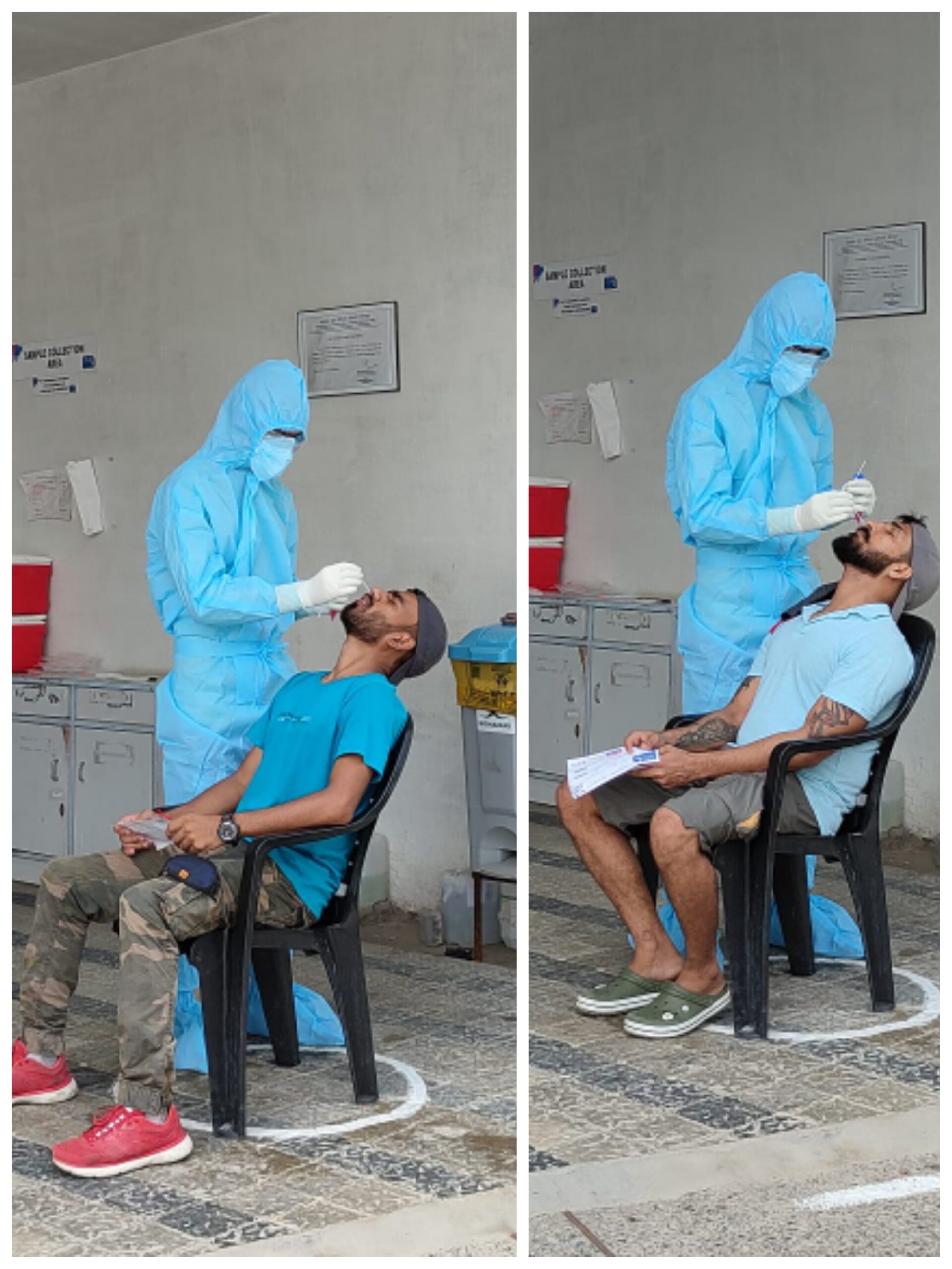 – RTPCR test at Dehradoon.
12th September 2020 : Dehradun to Gangotri
Despite being on this route earlier, there was a unique calmness yet an eerie feeling as we started our journey from Dehradun to Gangotri at around eight in the morning. A Sunday morning, Dehradun was having a complete lockdown and there was no traffic on the usually busy roads that day. The rest of the journey seemed even soothing because of a serene silence and lack of any transport on the road. Travelling after seven months and breathing the fresh air, undisturbed ,was an experience beyond description. After lunch at Suwakholi we reached Chiniyalisour and the move ahead was allowed only on production of negative RTPCR reports. Following the same procedure at Uttarkashi and Bhatwari, we finally reached our destination around 8 PM.
Gangotri, an all time beautiful and mesmerising place was completely isolated with almost the entire town being closed, except a few restaurants and shops. Adjusting to the never experienced silence of the place, we checked into our hotels and fell onto the beds, tired after a 12 hours of journey.
13th September 2020 : Rest and Acclimatization at Gangotri
The aspect of acclimatisation was even important as we had moved from Dehradun to Gangotri without any physical activity enroute and even so because all of us were lacking the feel of high altitude area for a gap of seven months, struck at our homes in pandemic. An important and Never to Forget aspect, acclimatisation is the golden rule for a mountaineer to allow the body to adjust to the rarefied atmosphere. We started our day by a holy dip in the cold current of Bhagrathi river and utilized the day in our bag-packing. Though each of us had around 25kg of weight to carry but thanks to the ‘Osprey Either-Antigravity’ model rucksacks (strongly recommended for trekkers), we were in a comfortable weight carriage zone. All set to start the Kalindi Khal Trek next morning, we got a not so good news of delay in ILPs. On a brighter side, we got another day to acclimatise in lap of Gangotri.
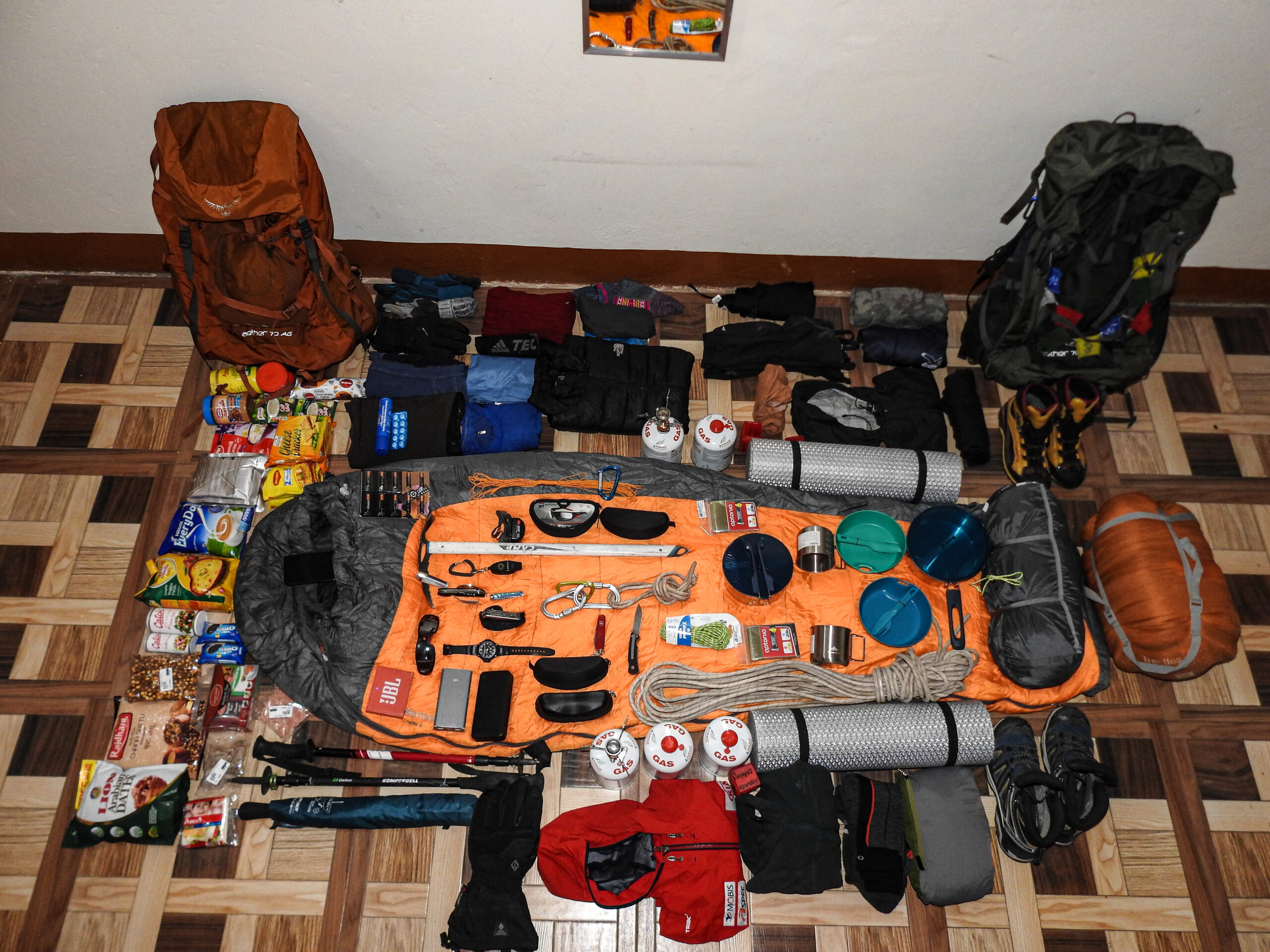 – Full display of all the stuffs we carried for the expedition
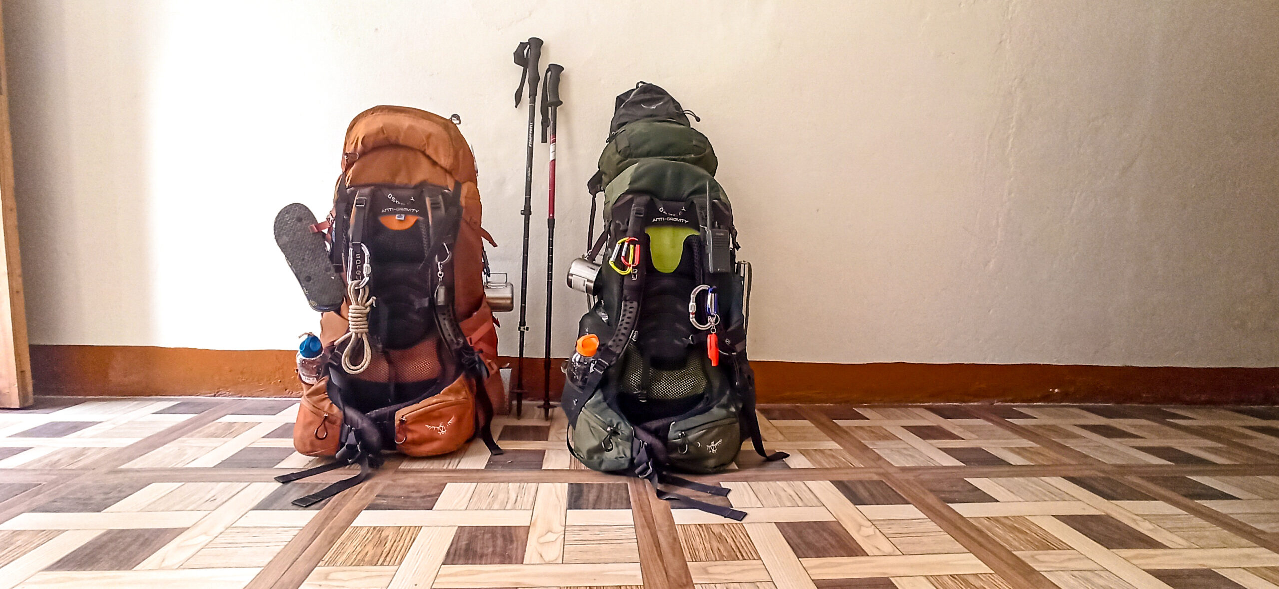 – Fully Loaded Backpacks (Osprey Aether-Antigravity)
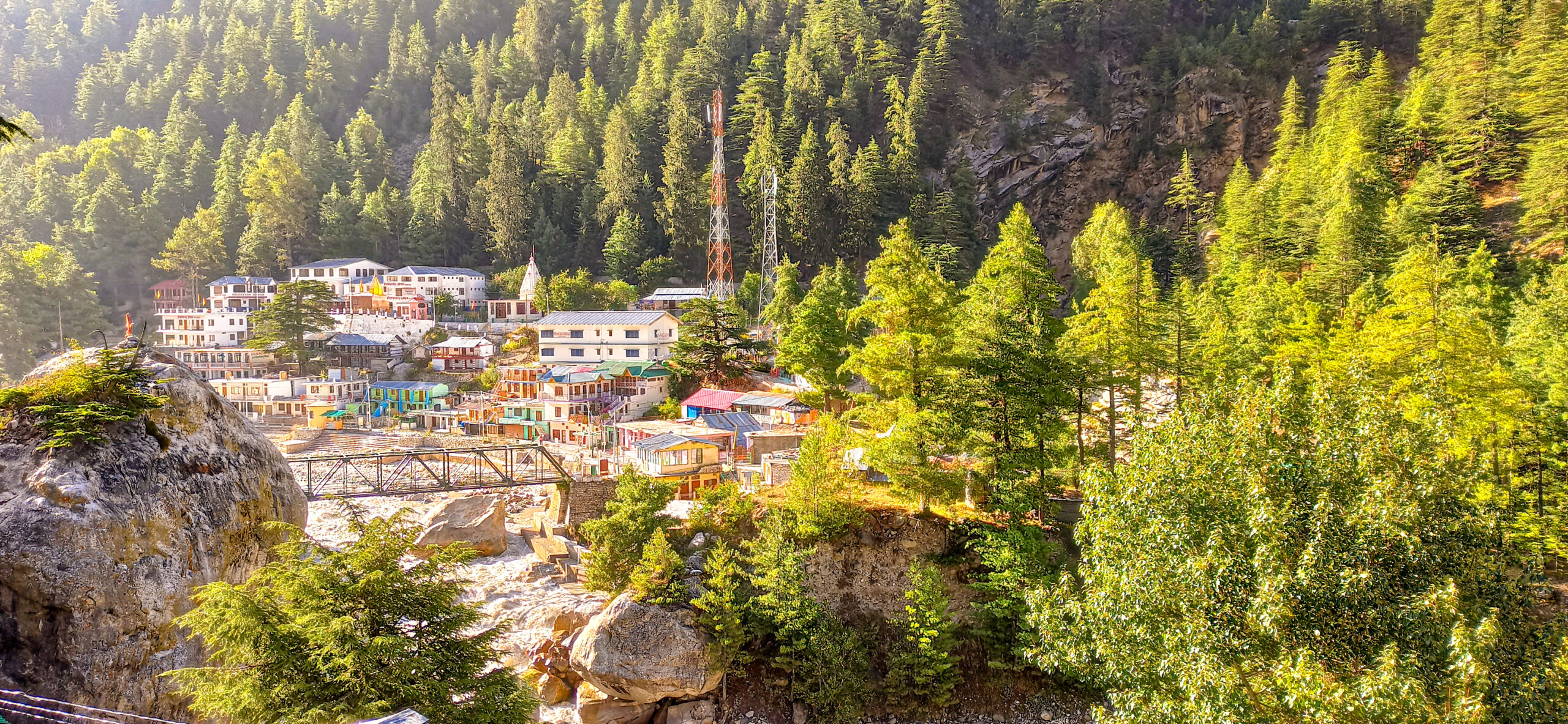 – Morning view of Gangotri Town
15th September 2020 : Gangotri to Chirbasa
The delay in permissions led to a delayed trek start and we cleared the Gangotri National Park check post at around 1.30 PM. The lack of practise due to pandemic could easily be felt on the first day of trek as we and the fellow team found ourselves lonely on the trail, a sight never anticipated. With a nice view of Mt Sudarshan, we tried to re-adjust to the long lost feel of carrying an Alpine loaded backpack. A collective decision to Camp at Chirbasa at around 6 PM was taken due the slow pace and a delayed start on the first day. The place derives its name from the abundant of pine trees, known as ‘Chir’ in Hindi. Nature had changed the course of the existing stream near the campsite forcing us to fetch the not so clean water from the river (nature rules and you obey!). A butane cooked Maggie some biscuits was followed by the sleep in the forest huts.
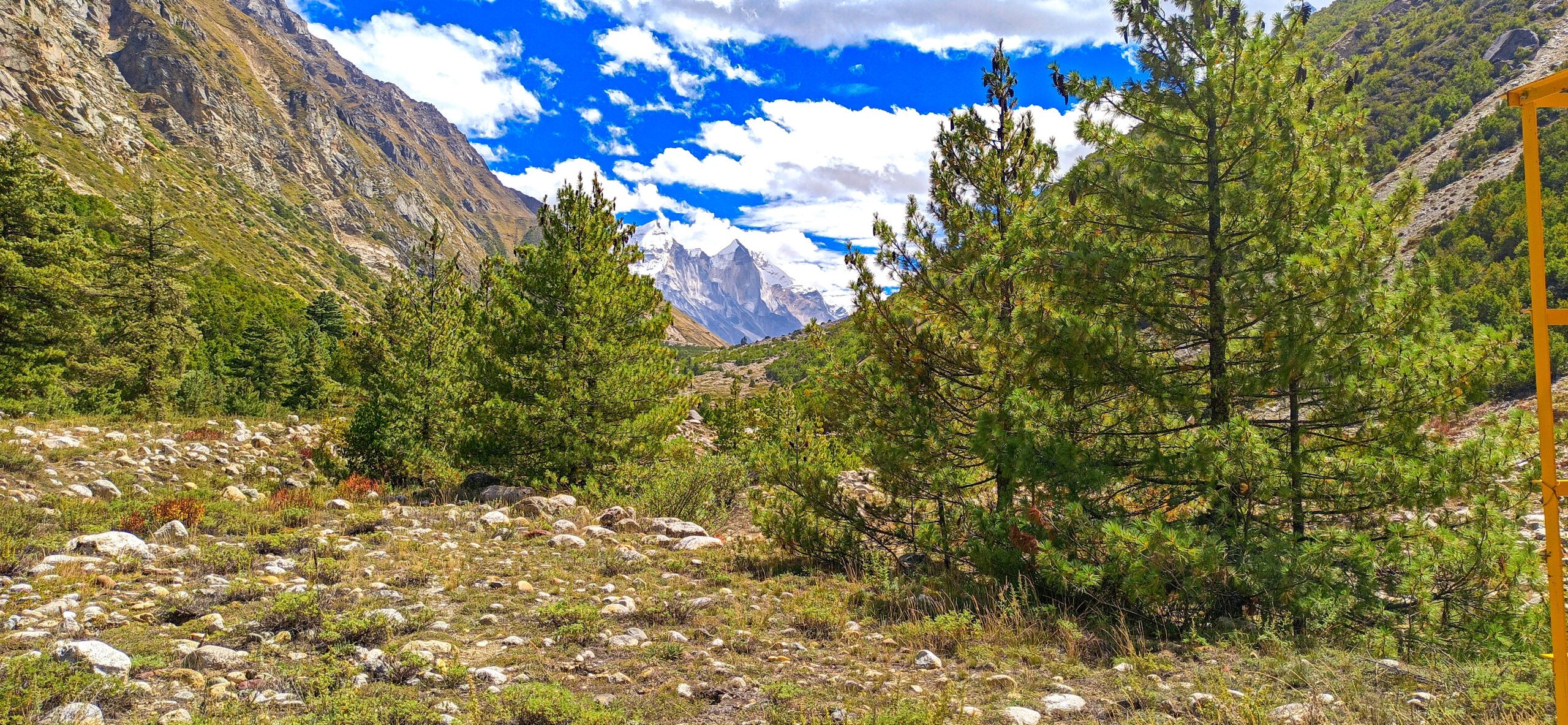
– Glimpse of Gangotri Massif from Chirbasa Campsite
16th September 2020 : Chirbasa to Bhojbasa
What else could one ask for than waking up to a surreal view of Bhagirathi massif and Mt Manda (a replica of Mt Kailash). The existing plan to hit Nandanvan was modified as the old direct route was now in a state of disuse due to a land slide and a new route from the left bank of Bhagirathi river, to be crossed by a trolley bridge to Bhojbasa, had to adopted (flexibility is the key, remember?).

– Panoramic view of Bhojbasa campsite, Gaumukh, Bhagirathi river with Bhagirathi Massif at the back
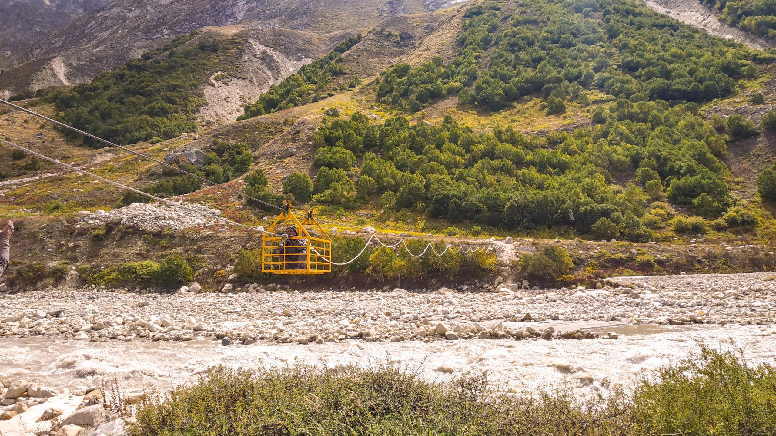
– The trolley bridge on to cross the Bhagirathi river
Crossing both the teams through that bridge took us around 2.5 hours, forcing us to camp an hour ahead of Bhojbasa on the opposite side of the river. Akin to Chirbasa, Bhojbasa got its name due to abundance of ‘Bojpatra’ ( Burj in English) trees. Crossing a huge team from the bridge required a good amount of teamwork and we hit the campsite around 3 PM.
We thanked Mother Nature for a stream of clean water near the campsite. We pitched our tents, prepared hot coffee and enjoyed the evening. We decided to utilise the Shahi Paneer and Veg Pulao of MTR ready to eat meals ( would strongly recommend to alpine trekkers! ), enjoying the experience of cooking it on butane, a very convenient, light weight and reliable method, yet requiring a good amount of precaution due to its highly inflammable nature.

– Bhojwasa Campsite
17th September 2020 : Bhojbasa to Nandanvan
We had our breakfast, wrapped up the camp and started our trek at around 8 AM. After an hour of trek, we reached Gaumukh, the snout of Gangotri glacier and also the origin of Bhagirathi river. Gaumukh means ‘Cow’s Mouth’ and depicted the shape of erstwhile snout, which over the years, due to global warming and natural disturbances, now looks like a cave. I remember this place from the first time in the year 2017 during my IMF Medical Expedition and have been lucky to visit this place once every year. I could personally relate to this change over past 4 years.
( The history has it that Gangotri glacier is about 30 km long and about 4 km wide and holding about 27 cubic km of ice. Over the last 30 years, glacier has receded for about 1.5 km ).

– View of Gaumukh cave
After taking photos and videos we started the trek, traversed the whole glacier and moved to the old route, reaching a point where we saw that there was another landslide making the route dangerous with steep ascend with loose rocks, just after the junction of Chaturangi and Gangotri glacier.
Exercising caution during treks is as important as enjoying them, I realised it again as during our move, a big boulder of around 3 feet slipped from my step and start sliding downwards on the trail. We were very lucky that it stopped and did no harm, which otherwise, would have led to a serious injury. This was followed by another rock fall by the footsteps of one of the porters behind me but luckily it didn’t result in any injury as well.
We reached Nandanvan safely at around 4PM with the campsite located on the footsteps of Bhagirathi massif, which also serves the role of base camp for the expeditions to Mt Bhagirathi. Clear weather gave us a nice view of surroundings with many majestic mountains including Mt Shivling , Mt Meru, Mt Kedar dome, Mt. Kharchakund, Bhagirathi Massif and Vasuki Parvat. Among the beautiful peaks, the one that distinctly catches your attention is Mt Shivling, seldom does one see such a majestic and towering peak that remains etched in one’s mind forever! The most beautiful part of this peak are its shades at different parts of the day. The streams of Nandanvan were full of water which tend to dry from October onwards. We pitched our tents facing Mt Shivling to make sure that we do not miss the satiating view of this beast at the first light. Tired, yet happy, we cooked dinner and called it a day.
18th September 2020 : Nandanvan to Vasuki tal
After having a nice breakfast with a perfect view of Mt Shivling, we wrapped the camp and started the trek towards Vasuki tal at around 10AM.

– Morning breakfast with the perfect view of majestic Mt. Shivling
As anticipated, the beautiful trail was an easy one (without boulders and moraines), all along the streams which gradually met the ridge. We walked around for an hour and a half on the extremely windy ridge with Chaturangi glacier on our left and a number of turquoise blue coloured glacial lakes (tarns).
( The silt is created when rocks underneath the surface of the ice grind due to the movement of the glacier. The rock flour is very light and stays suspended in the lake water for a long time. The sunlight that reflects off these particles is what gives the lakes their spectacular turquoise blue or green colour ).
We reached the point where we had to descend down on the Vasuki glacier and climb the technical section of around 50 feet (gulley) by fixing a rope. From this point one could see the full stretch of Chaturangi glacier and the campsite of Khadapathar . Generally, this section has a prefixed rope, as Vasuki is the base camp for Mt Satopanth expedition and a number of teams attempt this peak, but the COVID 19 seemed to break the stereotypes. We waited for the Bikat team to reach the point and decided to move ahead collectively. The Vasuki glacier had also receded compared to our previous visit.
We went ahead with the necessary equipment and fixed the rope with an additional belay rope, aimed to make a comfortable ascent for the porters carrying heavy loads. Bearing the threat of loose rocks and steepness of the wall, we fixed the ropes very diligently to avoid any untoward incident, especially, for the supporting party at the bottom. A three-hour effort to cross the gulley left the entire team cold and tired due to restricted movement during the move. We reached the campsite around 6PM and located ourselves just beside the lake below Vasuki Parvat, fed by the streams coming from the glacier of the mountain ( fond memories of this place of our medical expedition came to fore, when we had spent around 5 days here ).
– The two alpinist with the dream peak at the back
19th September 2020 : Vasuki tal to Khadapathar
Tired by the last day’s effforts, we woke up a little late and started the trek around 10AM. An hour of trek and we got the glimpse of Mt Satopanth, the stories of which one would often hear from friends, Sherpas and instructors, especially the 800 metre long knife ridge! We were lucky to have Somnath with us who had summited Mt Satopanth in the year 2017 and briefed us about the the route, location of the campsites etc. Truly fascinated, we managed a steep yet safe descent down the Chaturangi glacier to the moraines, unstable boulders and undulating ground till the campsite by 3PM. The campsite, a small flat area just below of Khadapathar (a giant bolder), surrounded by mountains on its three sides with a small stream flowing through it, provided adequate sunlight and wind proofing ( bliss! ).

– First rays of sun at Khadapathar campsite
20th September 2020 : Khadapathar Shweta Glacier
Starting our day at around 9AM, we encountered a similar trail as the previous day. An hour of walk and we again descended on the Chaturangi glacier. A short span of trek and we got a munificent, wider and clearer view of Mt Satopanth. We crossed the Chaturangi glacier and traversed to the next corner of Shweta glacier, encountering a number of tarns and crevasses, till we reached the campsite at around 3PM. The campsite today was on the moraines near a small tarn and we had to flatten the area before pitching our tents.

– View of Mt. Satopanth enroute Shweta Glacier
21th September 2020 : Rest and acclimatization at Shweta Glacier
We decided to have a rest day as we had skipped our rest day at Vasuki tal. The continuous long walks on boulders and moraines from last three days led us to take a much needed rest at Shweta glacier to recoup for the upcoming challenging times. The morning ritual of water collection at Shweta glacier was my favourite as the little tarn had frozen completely due to sub-zero temperature and we had to break the top layer by hitting it hard with a big stone and then filling the bottles with our mugs. We spent the day cleaning up ourselves and relaxing.
– Unique way of water collection.
22th September 2020 : Shweta Glacier to Kalindi Base
Akin to the route of the previous day, the trek started along the corner of Shweta glacier and then turned into a different valley. After two hours of walk we reached a point from where we could see the Avalanche peak and Kalindi peak . The view of this valley was surreal and mesmerising in its own way! A two hours of trek from this point took us to the campsite, located at the base of Avalanche peak, after crossing a few streams and a crunchy white glacier. Even today, the campsite was full of moraines with a similar water source as that of the previous day and small glacial ponds. Being on the ridge, the campsite was extremely cold and windy, making this campsite a difficult place. We called it a day early and tried to sleep but could hear the sounds of avalanches very frequently throughout the night.

– Coffee at Kalindi base camp
23th September 2020 : Kalindi Base to Kalindi Pass and Raj Padav
This being the penultimate day of our trek brought with it a series of adventures. An early rise and breakfast was followed by leaving the campsite at around 5.45 AM. We used our headlamps till the visibility was optimal and walked on the ridge for around 45 minutes to find a better location of campsite in terms of distance from the Kalindi pass . We encountered a spectacular glacier on the left, looking like an icefall area and moved ahead to reach a tricky section with a wide crevasse

– Unnamed glacier, on the left of Kalindi Base. The second most beautiful spot of the Kalindi Khal Trek.
Bypassing this crevasse successfully ( no options! ), we reached the white and crunchy glacier, coming all the way from the pass. The view of the pass from this point was awe striking and the ice-field ahead was full of huge, wide and open crevasses. The gradient was normal except a steep ascent of last 300 metres.

– The final steps to the pass.
It took us around 3 hours to reach the top of the pass which welcomed us with the beautiful view of Mt Kamet (right in front of us) alongwith other famous peaks like Mt Abhigamin, Mt Mukut and Mt Mana; Mt Avalanche and Mt Kalindi on either sides and Mt Chandra, Vasuki Parvat and Mt Thalaysagar in the rear. this final top view on kalindi khal trek makes anyone fall for it.

– At the top of Kalindi Khal (5950 m)
– 360 view from the pass.
Awe struck, we thanked and prayed to Badri Vishal for blessing us with such a perfect weather with absolute serenity, silence and zero wind. I collected some trash from the top of the pass and carried it along in my rucksack. (It perturbs me to see people leaving lighter things, having consumed the heavier ones and spoiling the place, especially coming from a civilization, where we treat the mountain and rivers as Gods, yet limit the teachings to texts). There were two giant glacial fields during the descend to Raj Padav, with the lower one having a number of small and big crevasses. A ridge full of moraines took us to Raj Padav (a flat ground along the stream) by 4PM. Tired and exhausted, yet satiated we had our dinner followed by a cosy good night sleep.
24th September 2020 : Raj Padav to Ghastoli via Arva Tower.
Waking up the next this day we decided to skip the intermediate campsite ‘Arva Tower’ and trek directly to Ghastoli . Lesser did we realise how challenging the day would be, especially having trekked over countless moraines and crossing so many glaciers for last several days, that we decided to cover the whole 25 km of stretch in a single day. We knew that it was not going to be easy, but on the positive side, we would be reaching Joshimath . ( The greed of civilisation, the luxury of bed, and shower, the network zone and riddance to the painful boulders and moraines forced us to take this tough call! ).
The initial trail was a gradual descent for about an hour, till we reached a river crossing. Another half an hour and we were welcomed crossing of Arva river.
– River crossing before Arwa tower
Negotiating the strong current, we moved to a boulder trail and as luck would have it, the weather Gods started to develop disliking for us! The wind and chill factor multiplied leading us to stop near a big boulder and add more layers and gloves. The sudden spell of snow and head wind added to the existing difficulties. With no options but to continue walking amidst these conditions, we felt slight relief after around three hours with stoppage of snowfall. Adding to relief was the view of small meadows, full of wild little beautiful flowers and the signal by GPS showing us getting closer to Ghastoli. The fresh snowfall had left the surroundings beautiful and fresh but we were already into the wee hours of the day. The sight of ITBP, Ghastoli camps was now visible and we were expecting to reach there in short span of time. As the luck would have it, a mistake in the route got us delayed by an hour and a half and we hit the road head. We moved to the right of Nag Tal (a medium size lake) near the confluence of Arwa and Saraswati river, a detour of about 150 metres and covered this patch with a help of headtorch. The moonlit night made the whole area look surreal as the lack of sunlight during day was compensated by the moonlight at night. ( I wished to see this entire area someday in broad daylight and promised myself to return to this place in future .)
We reached Ghastoli at around 8PM. The abundance of boulders on the trail on this expedition was such that even our last step from the trail to roadhead was also from a boulder. The feeling of walking on the flat road was unbelievable and so was the sight to see civilization, vehicles, and other human beings. We were greeted by the ITBP Officials with hot water and tea. We completed the mandatory documentation at Ghastoli and boarded our respective vehicles for drive to Badrinath.
Unfortunately, we were not able to do Badrinath darshan as it was very late in the night ( there’s a very common saying that ‘You will only be able to do the darshan, once there’s an invitation from the God’ ) . It took us three and a half hours to reach Joshimath. We were very thankful to God for our safe and successful completion of the Kalindi khal trek.
I personally believe that for each and every successful expedition/trek the Mother Nature plays a far important role than that of the team. At last, I must admit that this was our most challenging Himalayan journey. The experience of Kalindi khal trek was awesome, we learnt so many new things, explored another beautiful and remote part of Indian Himalayas.
‘Thanks a ton to the Mother Nature, Maa Ganga and Badri Vishal’
Author

A passionate mountaineer with 6 years of outdoor experience, lead a total of 80+ Treks, Cycling and Mountaineering Expedition in Indian Himalayas and Sahyadris, Cyclist, Rock-Climber, Still-Water Kayaker. Explorer from the heart who wants to see the whole world. Love to practice Yog and read book in my free time.Message to the world- “Behave like Water”


really we did a great job, will do more amazing adventures together in future.